Shop
-
All Product
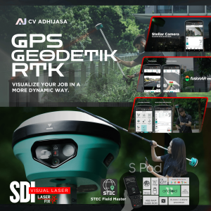
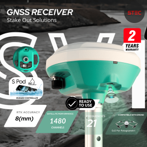
GPS RTK STEC SDi GNSS Receiver With EDM Technology
Harga aslinya adalah: Rp265.000.000.Rp155.000.000Harga saat ini adalah: Rp155.000.000. Tambah ke keranjang -
All Product
Gps RTK STEC SE Lite Base Rover Fullset
Harga aslinya adalah: Rp125.000.000.Rp70.000.000Harga saat ini adalah: Rp70.000.000. Tambah ke keranjang -
All Product
GPS Geodetik RTK STEC SV1 Smart Viewer GNSS Receiver
Harga aslinya adalah: Rp175.000.000.Rp95.000.000Harga saat ini adalah: Rp95.000.000. Tambah ke keranjang -
All Product
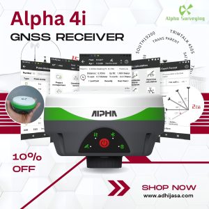
GPS Geodetik RTK Alpha 4i GNSS
Harga aslinya adalah: Rp60.000.000.Rp55.000.000Harga saat ini adalah: Rp55.000.000. Tambah ke keranjang -
All Product
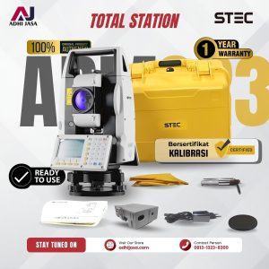
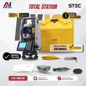
Total Station Laser STEC Armor3
Harga aslinya adalah: Rp45.000.000.Rp38.000.000Harga saat ini adalah: Rp38.000.000. Tambah ke keranjang -
All Product
Total Station Laser AXIS 1
Harga aslinya adalah: Rp52.000.000.Rp42.000.000Harga saat ini adalah: Rp42.000.000. Tambah ke keranjang -
All Product
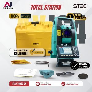
Total Station STEC AXIS 4 Series Laser
Harga aslinya adalah: Rp70.000.000.Rp65.000.000Harga saat ini adalah: Rp65.000.000. Tambah ke keranjang -
All Product
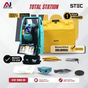
Total Station STEC Axis 9 Series TS Android High Precision
Harga aslinya adalah: Rp75.000.000.Rp70.000.000Harga saat ini adalah: Rp70.000.000. Tambah ke keranjang -
All Product
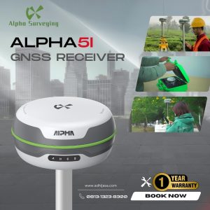
Alpha 5i Gnss RTK Gps Geodetik Statik
Harga aslinya adalah: Rp138.000.000.Rp95.000.000Harga saat ini adalah: Rp95.000.000. Tambah ke keranjang -
All Product
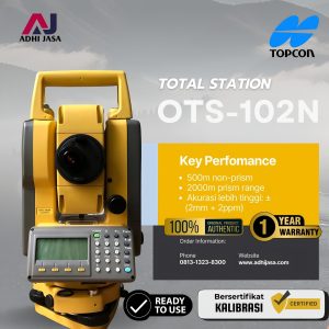
Total Station Topcon OTS-102N
Harga aslinya adalah: Rp58.000.000.Rp52.000.000Harga saat ini adalah: Rp52.000.000. Tambah ke keranjang -
Accesories
Skief Tribrach untuk Total Station Topcon Sokkia Nikon
Harga aslinya adalah: Rp150.000.Rp120.000Harga saat ini adalah: Rp120.000. Tambah ke keranjang -
All Product
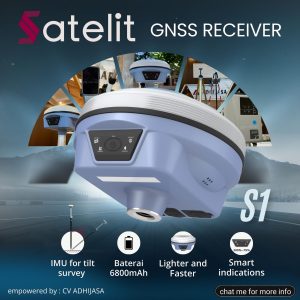
GPS GNSS Geodetik RTK Satelit S1 Base Rover
Harga aslinya adalah: Rp150.000.000.Rp95.000.000Harga saat ini adalah: Rp95.000.000. Tambah ke keranjang -
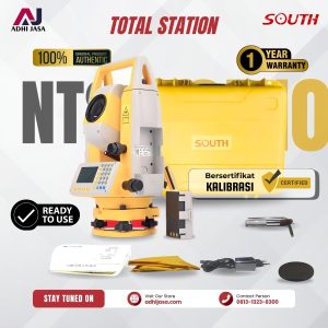
All Product
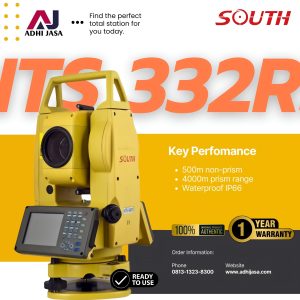
Total Station South NTS 332R5
Harga aslinya adalah: Rp45.000.000.Rp29.000.000Harga saat ini adalah: Rp29.000.000. Tambah ke keranjang -
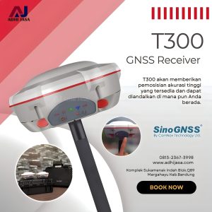
All Product
GPS RTK Comnav T300 GNSS Sino T300
Harga aslinya adalah: Rp110.000.000.Rp95.000.000Harga saat ini adalah: Rp95.000.000. Tambah ke keranjang -
Accesories
Rambu Bak Ukur Leveling Staff 5 Meter
Harga aslinya adalah: Rp700.000.Rp500.000Harga saat ini adalah: Rp500.000. Tambah ke keranjang -
All Product
Total Station Laser South NTS-332R10
Harga aslinya adalah: Rp45.000.000.Rp35.000.000Harga saat ini adalah: Rp35.000.000. Tambah ke keranjang -
Accesories
Battery GPS Pentax 10002 BL-200
Harga aslinya adalah: Rp2.000.000.Rp1.800.000Harga saat ini adalah: Rp1.800.000. Tambah ke keranjang -
Accesories
Baterai BL-5000 untuk Hi-Target H32 V30 V50 F61 F66 GNSS RTK GPS
Rp1.000.000 Tambah ke keranjang -
All Product
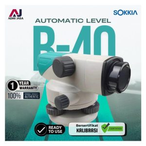
Automatic Level Sokkia B20
Harga aslinya adalah: Rp25.000.000.Rp23.000.000Harga saat ini adalah: Rp23.000.000. Tambah ke keranjang -
Accesories
Radio External GPS RTK Harxon HX-DU8608D
Harga aslinya adalah: Rp36.000.000.Rp33.000.000Harga saat ini adalah: Rp33.000.000. Tambah ke keranjang -
All Product
GPS GARMIN Montana 750i
Harga aslinya adalah: Rp25.000.000.Rp19.000.000Harga saat ini adalah: Rp19.000.000. Tambah ke keranjang -
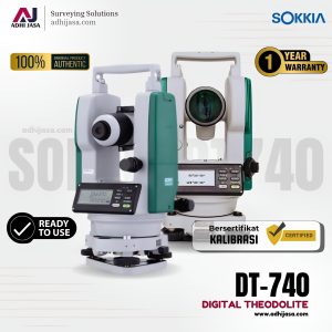
All Product
Digital Theodolite SOKKIA DT-740
Harga aslinya adalah: Rp62.000.000.Rp55.000.000Harga saat ini adalah: Rp55.000.000. Tambah ke keranjang -
All Product
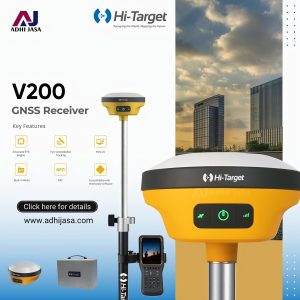
GNSS GPS RTK Geodetik HI-Target V200
Harga aslinya adalah: Rp200.000.000.Rp130.000.000Harga saat ini adalah: Rp130.000.000. Tambah ke keranjang -
All Product
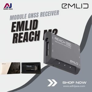
Module for GNSS GPS Emlid Reach M2 Modul
Harga aslinya adalah: Rp36.000.000.Rp22.000.000Harga saat ini adalah: Rp22.000.000. Tambah ke keranjang -
All Product
GNSS GPS RTK Geodetik Emlid Reach RS+
Harga aslinya adalah: Rp65.000.000.Rp55.000.000Harga saat ini adalah: Rp55.000.000. Tambah ke keranjang -
Accesories
Extension Pole Mini Universal untuk GPS RTK
Harga aslinya adalah: Rp170.000.Rp120.000Harga saat ini adalah: Rp120.000. Tambah ke keranjang -
Accesories
Prisma AK Target Detail Leica Offset
Harga aslinya adalah: Rp2.000.000.Rp1.500.000Harga saat ini adalah: Rp1.500.000. Tambah ke keranjang -
All Product
GPS RTK GNSS Trimble R4s
Harga aslinya adalah: Rp389.000.000.Rp379.000.000Harga saat ini adalah: Rp379.000.000. Tambah ke keranjang -
Accesories
Prisma Target Prism Single AK Leica GPR111
Harga aslinya adalah: Rp2.000.000.Rp1.700.000Harga saat ini adalah: Rp1.700.000. Tambah ke keranjang -
All Product
Automatic Level Digital Orion 2LS Waterpass Digital Level Orion
Rp18.000.000 Tambah ke keranjang -
Accesories
Charger GPS South CHRD-SA3001, untuk GPS South 9600 S82,S86,Galaxy G1
Rp2.000.000 Tambah ke keranjang -
All Product
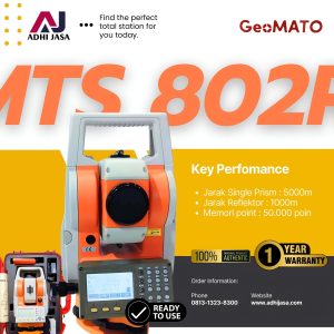
Total Station Laser Geomato MTS802R+
Harga aslinya adalah: Rp45.000.000.Rp36.000.000Harga saat ini adalah: Rp36.000.000. Tambah ke keranjang -
Accesories
Baterai Total Station Topcon ES-600G/HIPER II BTL2 Original
Harga aslinya adalah: Rp2.200.000.Rp2.000.000Harga saat ini adalah: Rp2.000.000. Tambah ke keranjang -
Accesories
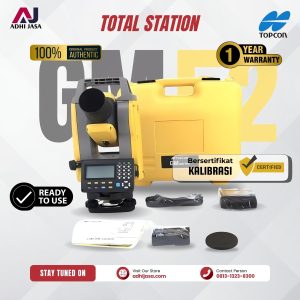
Baterai Topcon BDC72 Total Station Topcon GM-52
Harga aslinya adalah: Rp2.200.000.Rp2.000.000Harga saat ini adalah: Rp2.000.000. Tambah ke keranjang -
Accesories
GPS Tribrach plus Adaptor Carrier
Harga aslinya adalah: Rp2.500.000.Rp2.300.000Harga saat ini adalah: Rp2.300.000. Tambah ke keranjang -
All Product
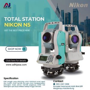
Total Station Nikon N5 Laser
Harga aslinya adalah: Rp85.000.000.Rp75.000.000Harga saat ini adalah: Rp75.000.000. Tambah ke keranjang -
All Product
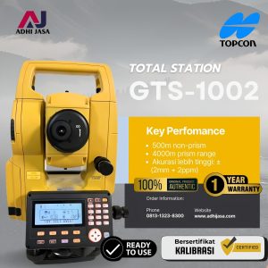
Total Station Topcon GTS 1002
Harga aslinya adalah: Rp69.000.000.Rp66.000.000Harga saat ini adalah: Rp66.000.000. Tambah ke keranjang -
All Product
Alpha Li Automatic Level Waterpass
Harga aslinya adalah: Rp5.500.000.Rp4.200.000Harga saat ini adalah: Rp4.200.000. Tambah ke keranjang -
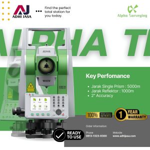
All Product
Alpha Ti Total Station Laser
Harga aslinya adalah: Rp45.000.000.Rp38.000.000Harga saat ini adalah: Rp38.000.000. Tambah ke keranjang -
All Product
Leica Geosystem Disto X4 Distometer Laser
Harga aslinya adalah: Rp9.500.000.Rp7.800.000Harga saat ini adalah: Rp7.800.000. Tambah ke keranjang -
All Product
Mileseey MC8066A GPS Handheld
Harga aslinya adalah: Rp2.500.000.Rp1.500.000Harga saat ini adalah: Rp1.500.000. Tambah ke keranjang -
All Product
3D/4D Green Laser Level Hilda Cross 12 Line
Harga aslinya adalah: Rp2.600.000.Rp2.000.000Harga saat ini adalah: Rp2.000.000. Tambah ke keranjang -
All Product
Multi Green Line Laser Aline AL-3DG
Harga aslinya adalah: Rp10.000.000.Rp7.000.000Harga saat ini adalah: Rp7.000.000. Tambah ke keranjang -
All Product
Drone DJI Phantom 4 Pro+ V2.0
Harga aslinya adalah: Rp38.000.000.Rp35.000.000Harga saat ini adalah: Rp35.000.000. Tambah ke keranjang -
All Product
Total Station Robotic Sokkia IX-1201
Harga aslinya adalah: Rp1.200.000.000.Rp900.000.000Harga saat ini adalah: Rp900.000.000. Tambah ke keranjang -
Accesories
Distometer Laser SNDWAY SW-TG120
Harga aslinya adalah: Rp2.200.000.Rp1.100.000Harga saat ini adalah: Rp1.100.000. Tambah ke keranjang -
Accesories
GPS RTK Pole Power Battery BL-10000 Trimble
Harga aslinya adalah: Rp8.500.000.Rp6.500.000Harga saat ini adalah: Rp6.500.000. Tambah ke keranjang -
All Product
GPS MAP Garmin Etrex 10 Handheld
Harga aslinya adalah: Rp4.500.000.Rp3.000.000Harga saat ini adalah: Rp3.000.000. Tambah ke keranjang -
All Product
GPS MAP Handheld Garmin 66s
Harga aslinya adalah: Rp8.300.000.Rp7.000.000Harga saat ini adalah: Rp7.000.000. Tambah ke keranjang -
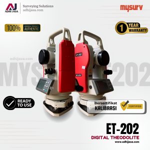
All Product
Digital Theodolite MYSURV ET-202 DT-202
Harga aslinya adalah: Rp20.000.000.Rp13.500.000Harga saat ini adalah: Rp13.500.000. Tambah ke keranjang -
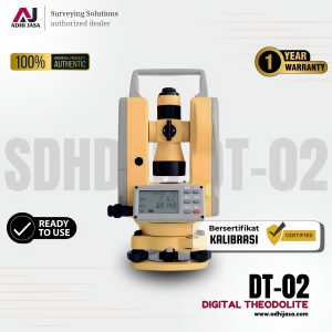
All Product
Digital Theodolite SDHDVD DT2
Harga aslinya adalah: Rp30.000.000.Rp25.000.000Harga saat ini adalah: Rp25.000.000. Tambah ke keranjang -
Accesories
Prisma Mini Leica non Stik Offset 0/-30 Mm
Harga aslinya adalah: Rp1.750.000.Rp1.500.000Harga saat ini adalah: Rp1.500.000. Tambah ke keranjang -
Accesories
Refill Nivo Tabung Kotak untuk Nivo Tribrach akurasi 60″/2mm
Harga aslinya adalah: Rp175.000.Rp125.000Harga saat ini adalah: Rp125.000. Tambah ke keranjang -
All Product
Nivo Tabung Kotak 60″/2mm untuk Tribrach
Harga aslinya adalah: Rp250.000.Rp200.000Harga saat ini adalah: Rp200.000. Tambah ke keranjang -
Accesories
Safety Ear Pelindung Telinga
Harga aslinya adalah: Rp450.000.Rp300.000Harga saat ini adalah: Rp300.000. Tambah ke keranjang -
Accesories
Flagging Tape Pita Ukur Survey
Harga aslinya adalah: Rp50.000.Rp30.000Harga saat ini adalah: Rp30.000. Tambah ke keranjang -
Accesories
Dudukan Skief U Waterpass Autolevel
Harga aslinya adalah: Rp50.000.Rp35.000Harga saat ini adalah: Rp35.000. Tambah ke keranjang -
Accesories
Tas Ransel Drone DJI Phantom 4
Harga aslinya adalah: Rp2.400.000.Rp2.000.000Harga saat ini adalah: Rp2.000.000. Tambah ke keranjang -
Accesories
Tas Hardcase Handheld Garmin
Harga aslinya adalah: Rp175.000.Rp100.000Harga saat ini adalah: Rp100.000. Tambah ke keranjang -
Accesories
Tas Softcase Prisma Single AK Topcon
Harga aslinya adalah: Rp175.000.Rp100.000Harga saat ini adalah: Rp100.000. Tambah ke keranjang -
Accesories
Tas Prisma ADS Polygon Softcase
Harga aslinya adalah: Rp225.000.Rp175.000Harga saat ini adalah: Rp175.000. Tambah ke keranjang -
Accesories
Besi Lancip Kuku Stik/ Pole/ Jalon Merah Putih
Harga aslinya adalah: Rp175.000.Rp100.000Harga saat ini adalah: Rp100.000. Tambah ke keranjang -
Accesories
Tilt Total Station Topcon Sokkia CX, ES,GM
Harga aslinya adalah: Rp9.500.000.Rp8.000.000Harga saat ini adalah: Rp8.000.000. Tambah ke keranjang -
Accesories
Motherboard Untuk Total Station Topcon GTS Series
Harga aslinya adalah: Rp7.500.000.Rp7.000.000Harga saat ini adalah: Rp7.000.000. Tambah ke keranjang -
Accesories
Laser Untuk Total Station Topcon GM Series
Harga aslinya adalah: Rp7.500.000.Rp7.000.000Harga saat ini adalah: Rp7.000.000. Tambah ke keranjang -
Accesories
Holder Drat Stik/ Pole/ Jalon Survey Besar
Harga aslinya adalah: Rp125.000.Rp100.000Harga saat ini adalah: Rp100.000. Tambah ke keranjang -
Accesories
Holder Drat Stik/ Pole/ Jalon Kecil
Harga aslinya adalah: Rp100.000.Rp80.000Harga saat ini adalah: Rp80.000. Tambah ke keranjang -
Accesories
Drat Prisma Adapter Prisma
Harga aslinya adalah: Rp125.000.Rp100.000Harga saat ini adalah: Rp100.000. Tambah ke keranjang -
Accesories
Adapter Drat Stik Jalon Pole Untuk Prisma Leica Besar
Harga aslinya adalah: Rp125.000.Rp100.000Harga saat ini adalah: Rp100.000. Tambah ke keranjang -
Accesories
Adaptor Drat Stik Pole Prisma Leica (Kecil)
Harga aslinya adalah: Rp100.000.Rp80.000Harga saat ini adalah: Rp80.000. Tambah ke keranjang -
Accesories
Base Level Autolevel Waterpass
Harga aslinya adalah: Rp1.400.000.Rp1.000.000Harga saat ini adalah: Rp1.000.000. Tambah ke keranjang -
Accesories
Tripod Statif Topcon Untuk Total Station GPS RTK Original
Harga aslinya adalah: Rp2.000.000.Rp1.250.000Harga saat ini adalah: Rp1.250.000. Tambah ke keranjang -
Accesories
Alumunium Tripod Statif Sokkia Type
Harga aslinya adalah: Rp2.000.000.Rp1.250.000Harga saat ini adalah: Rp1.250.000. Tambah ke keranjang -
Accesories
Stik Pole Jalon Merah Putih 2,5 Meter
Harga aslinya adalah: Rp1.000.000.Rp900.000Harga saat ini adalah: Rp900.000. Tambah ke keranjang -
Accesories
Extension Pole Mini 25 cm Kuning Universal
Harga aslinya adalah: Rp700.000.Rp400.000Harga saat ini adalah: Rp400.000. Tambah ke keranjang -
Accesories
Pole Stik Jalon Carbon untuk GPS RTK
Harga aslinya adalah: Rp2.200.000.Rp2.000.000Harga saat ini adalah: Rp2.000.000. Tambah ke keranjang -
Accesories
Rambu Bak Ukur Leveling Staff 3 Meter
Harga aslinya adalah: Rp600.000.Rp400.000Harga saat ini adalah: Rp400.000. Tambah ke keranjang -
Accesories
Sheet Stiker Sokkia Target Prisma 50mm
Harga aslinya adalah: Rp50.000.Rp30.000Harga saat ini adalah: Rp30.000. Tambah ke keranjang